Location: Nerang, Gold Coast QLD, Australia
Distance: 17.2km
Total Elevation Gain: 644m
Trail Map: To view at full size and/or print; click on the image to open the map, then right click and select 'save image as'. Open the map from the save location to view at full size.

The Department of National Parks, Recreation, Sport and Racing have recently released a map outlining the firetrails within Nerang NP and SF and it's accessible here.
The best time of day to run in the state forest is early morning when it isn't too hot, as the trails can get mighty dry and warm when the sun is high overhead. You also don't want to run too late if you don't know the area.
Most of all, enjoy it! Nerang SF is a great place to run and work on your trail skills - there is something in there for everyone!
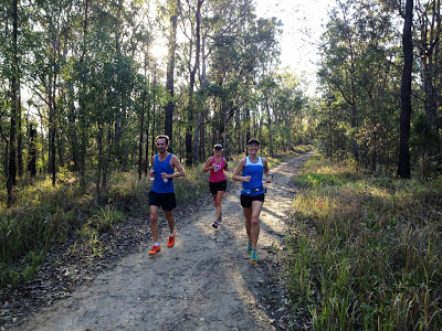
Run Type: Trail | Firetrail, rocky, climbs, forest, scenic, creek crossings
Distance: 17.2km
Total Elevation Gain: 644m
Trail Map: To view at full size and/or print; click on the image to open the map, then right click and select 'save image as'. Open the map from the save location to view at full size.
The Department of National Parks, Recreation, Sport and Racing have recently released a map outlining the firetrails within Nerang NP and SF and it's accessible here.
Nerang State Forest comprises three basic types of trails:
1. Wide firetrails, mainly hard dirt with embedded stones and rocks (these are the black solid lines on the map above);
2. Two dedicated mountain bike trails on which runners are not permitted (these are the brown trails on the above map); and
3. Unmarked single track (which is not shown on the above map - you'll need to find these gems yourself...which isn't too hard as they are literally everywhere!)
This trail is a challenging and hilly trail run, but it's well worth the effort and time to explore the trails in Nerang State Forest. The trail marked on the map above isn't too difficult to follow, so long as you are paying some attention to where you are when you meet trail junctions (keeping in mind that singletrack is not marked on the above map - firetrails only!). In the following description the trail names that reference the Judd Adventures map above will be marked in italics - note that the trails are not actually named when you are in the Forest!
The state forest is a big area, and it isn't too difficult to lose your bearings, even on the firetrails, so it's recommended that you run with a friend, carry some water and first aid supplies, carry a GPS device with you if possible (most phones can do this these days) and, at the very least, let someone know where you are going and your estimated time of return. That being said, if you print a copy of the above map, carry it with you on your run, and pay careful attention to where you are at track junctions, you shouldn't go too far wrong.
1. Wide firetrails, mainly hard dirt with embedded stones and rocks (these are the black solid lines on the map above);
2. Two dedicated mountain bike trails on which runners are not permitted (these are the brown trails on the above map); and
3. Unmarked single track (which is not shown on the above map - you'll need to find these gems yourself...which isn't too hard as they are literally everywhere!)
This trail is a challenging and hilly trail run, but it's well worth the effort and time to explore the trails in Nerang State Forest. The trail marked on the map above isn't too difficult to follow, so long as you are paying some attention to where you are when you meet trail junctions (keeping in mind that singletrack is not marked on the above map - firetrails only!). In the following description the trail names that reference the Judd Adventures map above will be marked in italics - note that the trails are not actually named when you are in the Forest!
- To start the run, enter the velodrome (easiest off Hope St), head across the criterium track, past the hall (keeping it on the left and the velodrome on the right), across the track again to where you will see a step-through in the fence. There is a map on the forest side of the fence showing the dedicated mountain bike trails - if you can't see this you're in the wrong place!
- From the entry point, head right on the main trail. You will initially be running on trail that has forest on one side and the backside of private properties on the other. After about 500m the trail heads north-west and you begin to move away from the residential area. Don't take any side trails on the right hand side during this time - stick to the main trail.
- Over the next 1km or so the trail continues to climb (for the most part), and you will pass a large-ish side trail on your right (marked Coolibah on the map) - keep left and continue in the north-westerly direction.
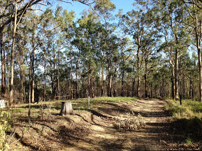
- At about the 1.7km mark, you will come to another trail junction (marked Castle Hill on the map) where a track heads off to the right (at about 90 degrees from the track you're on), and another track heads off to the left (this is a bend, but a continuation of the trail you are already on). Take the trail to the left.
- You soon come to a steep section...take a deep breath and tackle it! Once at the top (which you will get to!) you come to a t-junction - go right (heading left takes you down the hill and back to your original starting point).
- The next 1km or so is mostly gentle downhill, during which time you should get your breath back! Ignore any trails off to the right when on this stretch - keep on the main trail.
- At about the 3.4km mark, you again meet a challenging steep section. At the top of this climb you will come to another t-junction (marked A55 on the map) - go left. In going left, you will continue to climb for a little bit, but at a much lesser gradient.
- At about the 4.3km mark there will be a sign on your left marked 'advanced' that points down the hill - ignore it and stay on the main trail to the right (the advance trail is called Rollercoaster on the above map and it is some fun running, but not part of this loop!).
- About 200m on from this you will come to a major trail junction. Go right (this will take you onto the trail marked Kopps on the above map).
- This next bit is fast and fun downhill. Buckle up and enjoy the ride!
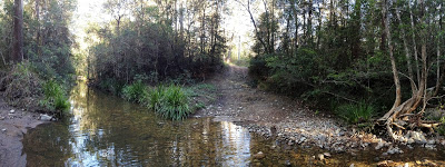
- At just over the 6km mark (you should have just crossed over a creek which may or may not have water in it depending on the time of year you run), your downhill fun finishes and you again begin to ascend. There are a few smaller sidetracks on your right during this ascent - ignore them.
- At about 7.4km, you will come to a minor t-junction, although the left hand trail - the one you want - is by far the more obvious. Do the obvious thing and take it! You are now on the trail marked Coombabah on the above map. About 200m on from this there will be a trail that goes off to your right - ignore it and continue straight.
- At just over the 10.1km mark you'll reach yet another t-junction. This one is big and obvious - go left, and you are now back on the trail marked Centre on the above map.
- At about 10.9km there will be a track on your right (Nerang) - ignore it and continue straight.
- At about 11.7km there will be a track on your right (Nathan/Crane) - ignore it and take the left-most option.
- At about 12.3km there will be a trail on your right marked 'advanced' - ignore it and stay on the main trail heading straight (the advanced trail, marked 'Billabirra' on the map, is another fast and fun section - maybe for another day!).
- At about 13.4km you will have a track off to your left, or the option to continue straight - go straight. (the left option will hopefully look familiar as this trail is Kopps - one you ran down earlier)
- The rest is basically back tracking, and so long as you stick to the main trail you won't go wrong. The difference on the return is that at about the 15.7km mark you will take the right turn at the fork junction (the left is the trail you came up at the start of your run - don't take it this time round). From here, follow the trail downhill and at the bottom turn left. You now have a gentle downhill run back to your start location!
The state forest is a big area, and it isn't too difficult to lose your bearings, even on the firetrails, so it's recommended that you run with a friend, carry some water and first aid supplies, carry a GPS device with you if possible (most phones can do this these days) and, at the very least, let someone know where you are going and your estimated time of return. That being said, if you print a copy of the above map, carry it with you on your run, and pay careful attention to where you are at track junctions, you shouldn't go too far wrong.
The best time of day to run in the state forest is early morning when it isn't too hot, as the trails can get mighty dry and warm when the sun is high overhead. You also don't want to run too late if you don't know the area.
Most of all, enjoy it! Nerang SF is a great place to run and work on your trail skills - there is something in there for everyone!
See you out there!